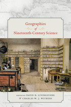
In Geographies of Nineteenth-Century Science, David N. Livingstone and Charles W. J. Withers gather essays that deftly navigate the spaces of science in this significant period and reveal how each is embedded in wider systems of meaning, authority, and identity. Chapters from a distinguished range of contributors explore the places of creation, the paths of knowledge transmission and reception, and the import of exchange networks at various scales. Studies range from the inspection of the places of London science, which show how different scientific sites operated different moral and epistemic economies, to the scrutiny of the ways in which the museum space of the Smithsonian Institution and the expansive space of the American West produced science and framed geographical understanding. This volume makes clear that the science of this era varied in its constitution and reputation in relation to place and personnel, in its nature by virtue of its different epistemic practices, in its audiences, and in the ways in which it was put to work.
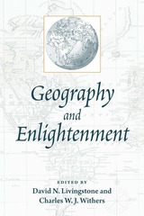
The first set of chapters charts the intellectual and geographical contexts in which Enlightenment ideas began to form, including both the sites in which knowledge was created and discussed and the different means used to investigate the globe. Detailed explorations of maps created during this period show how these new ways of representing the world and its peoples influenced conceptions of the nature and progress of human societies, while studies of the travels of people and ideas reveal the influence of far-flung places on Enlightenment science and scientific credibility. The final set of chapters emphasizes the role of particular local contexts in Enlightenment thought.
Contributors are Michael T. Bravo, Paul Carter, Denis Cosgrove, Stephen Daniels, Matthew Edney, Anne Marie Claire Godlewska, Peter Gould, Michael Heffernan, David N. Livingstone, Dorinda Outram, Chris Philo, Roy Porter, Nicolaas Rupke, Susanne Seymour, Charles Watkins, and Charles W. J. Withers.
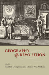
David N. Livingstone and Charles W. J. Withers assemble a set of essays that are themselves revolutionary in uncovering not only the geography of revolutions but the role of geography in revolutions. Here, scientific revolutions—Copernican, Newtonian, and Darwinian—ordinarily thought of as placeless, are revealed to be rooted in specific sites and spaces. Technical revolutions—the advent of print, time-keeping, and photography—emerge as inventions that transformed the world's order without homogenizing it. Political revolutions—in France, England, Germany, and the United States—are notable for their debates on the nature of political institutions and national identity.
Gathering insight from geographers, historians, and historians of science, Geography and Revolution is an invitation to take the where as seriously as the who and the when in examining the nature, shape, and location of revolutions.
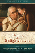
The Enlightenment was the age in which the world became modern, challenging tradition in favor of reason, freedom, and critical inquiry. While many aspects of the Enlightenment have been rigorously scrutinized—its origins and motivations, its principal characters and defining features, its legacy and modern relevance—the geographical dimensions of the era have until now largely been ignored. Placing the Enlightenment contends that the Age of Reason was not only a period of pioneering geographical investigation but also an age with spatial dimensions to its content and concerns.
Investigating the role space and location played in the creation and reception of Enlightenment ideas, Charles W. J. Withers draws from the fields of art, science, history, geography, politics, and religion to explore the legacies of Enlightenment national identity, navigation, discovery, and knowledge. Ultimately, geography is revealed to be the source of much of the raw material from which philosophers fashioned theories of the human condition.
Lavishly illustrated and engagingly written, Placing the Enlightenment will interest Enlightenment specialists from across the disciplines as well as any scholar curious about the role geography has played in the making of the modern world.
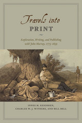
Drawing on detailed examination of the John Murray Archive of manuscripts, images, and the firm’s correspondence with its many authors—a list that included such illustrious explorers and scientists as Charles Darwin and Charles Lyell, and literary giants like Jane Austen, Lord Byron, and Sir Walter Scott—Travels into Print considers how journeys of exploration became published accounts and how travelers sought to demonstrate the faithfulness of their written testimony and to secure their personal credibility. This fascinating study in historical geography and book history takes modern readers on a journey into the nature of exploration, the production of authority in published travel narratives, and the creation of geographical authorship—a journey bound together by the unifying force of a world-leading publisher.
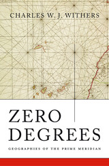
Space and time on earth are regulated by the prime meridian, 0°, which is, by convention, based at the Royal Observatory, Greenwich. But the meridian’s location in southeast London is not a simple legacy of Britain’s imperial past. Before the nineteenth century, more than twenty-five different prime meridians were in use around the world, including Paris, Beijing, Greenwich, Washington, and the location traditional in Europe since Ptolemy, the Canary Islands. Charles Withers explains how the choice of Greenwich to mark 0° longitude solved complex problems of global measurement that had engaged geographers, astronomers, and mariners since ancient times.
Withers guides readers through the navigation and astronomy associated with diverse meridians and explains the problems that these cartographic lines both solved and created. He shows that as science and commerce became more global and as railway and telegraph networks tied the world closer together, the multiplicity of prime meridians led to ever greater confusion in the coordination of time and the geographical division of space. After a series of international scientific meetings, notably the 1884 International Meridian Conference in Washington, DC, Greenwich emerged as the most pragmatic choice for a global prime meridian, though not unanimously or without acrimony. Even after 1884, other prime meridians remained in use for decades.
As Zero Degrees shows, geographies of the prime meridian are a testament to the power of maps, the challenges of accurate measurement on a global scale, and the role of scientific authority in creating the modern world.
READERS
Browse our collection.
PUBLISHERS
See BiblioVault's publisher services.
STUDENT SERVICES
Files for college accessibility offices.
UChicago Accessibility Resources
home | accessibility | search | about | contact us
BiblioVault ® 2001 - 2024
The University of Chicago Press


